
Category:Maps of Hainan
- Provinces of the People's Republic of China
- Anhui
- Fujian
- Gansu
- Guangdong
- Guizhou
- Hainan
- Hebei
- Heilongjiang
- Henan
- Hubei
- Hunan
- Jiangsu
- Jiangxi
- Jilin
- Liaoning
- Qinghai
- Shaanxi
- Shandong
- Shanxi
- Sichuan
- Yunnan
- Zhejiang
- Autonomous regions
- Guangxi
- Inner Mongolia
- Ningxia
- Tibet Autonomous Region
- Xinjiang
- Special administrative regions
- Hong Kong
- Macau
Wikimedia category | |||||
| Upload media | |||||
| Instance of | |||||
|---|---|---|---|---|---|
| Category combines topics | |||||
| Hainan | |||||
province of China  someja satełitar in novenbre .svg) | |||||
| Instance of | |||||
| Part of | |||||
| Location |
| ||||
| Located in or next to body of water | |||||
| Capital | |||||
| Legislative body |
| ||||
| Head of government |
| ||||
| Party chief representative |
| ||||
| Width |
| ||||
| Length |
| ||||
| Highest point |
| ||||
| Population |
| ||||
| Area |
| ||||
| Elevation above sea level |
| ||||
| official website | |||||
 | |||||
Subcategories
This category has the following 6 subcategories, out of 6 total.
Media in category "Maps of Hainan"
The following 36 files are in this category, out of 36 total.
-
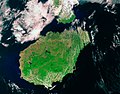
 Hainan Island topographical.jpg 3,809 × 3,290; 6.14 MB
-
 Wikivoyage Hainan Map Banner.jpg 3,809 × 548; 1.66 MB
-
 Hainan Island 1.jpg 1,419 × 1,056; 703 KB
-
 Hainan tmo 07feb05 250m.jpg 1,692 × 1,332; 2.02 MB
-
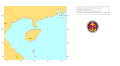
.svg/120px-Administrative_Division_Hainan_(PRC_claimed).svg.png) Administrative Division Hainan (PRC claimed).svg 1,419 × 1,000; 1.2 MB
Administrative Division Hainan (PRC claimed).svg 1,419 × 1,000; 1.2 MB
-
 Admiralty Chart No 3992 Hai-nan Tao to Hong Kong, Published 1961.jpg 16,157 × 11,061; 51.57 MB
-
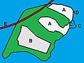 Beigang Island map - 01.jpg 848 × 645; 65 KB
-
 Bridges over the Nandu River - 2015.png 805 × 653; 23 KB
-
 Dazhou Island - map 01.jpg 1,040 × 786; 312 KB
-
 Dingcheng map - 01.png 1,629 × 1,201; 28 KB
-
.jpg/120px-Greenfield_Reservoir_(Hainan).jpg) Greenfield Reservoir (Hainan).jpg 1,464 × 1,516; 519 KB
Greenfield Reservoir (Hainan).jpg 1,464 × 1,516; 519 KB
-
 Hainan - Haikou - Nandu rivermap.png 852 × 667; 286 KB
-
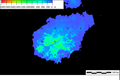
 Hainan Dialect Variation Map.png 2,455 × 2,048; 327 KB
-
 Hainan Island Campaign.png 1,124 × 791; 681 KB
-
 Hainan Province Shadow.svg 580 × 400; 1.42 MB
-
 Hainan satellite.JPG 992 × 735; 129 KB
-
 Hainan Shadow.svg 462 × 402; 616 KB
-
 Hainan topographical map - cropped.jpg 3,464 × 2,875; 8.18 MB
-
 Hainan topographical map.jpg 9,630 × 6,920; 11.35 MB
-
 Hainan visa free.png 1,425 × 625; 52 KB
-
 HainanFromSRTM30.PNG 598 × 400; 54 KB
-
 HainanProvinceControl.png 1,500 × 1,295; 236 KB
-
 Hainanshengquantu.JPG 432 × 614; 64 KB
-
 Illumine Lingao Map - Control Zone in Lingao County, Late Spring 1629.svg 11,339 × 15,874; 345 KB
-
_-_Fort_Bayard_-_Péninsule_de_Leizhou.png/120px-Kouang-Tchéou-Wan_(%22GuangzhouWan%22)_-_Fort_Bayard_-_Péninsule_de_Leizhou.png)
-
 Langues Hlaïes.png 424 × 386; 22 KB
-
 Linguistic Map of Hainan.svg 512 × 384; 261 KB
-
 Map of Hainan History.jpg 3,746 × 2,953; 681 KB
-

-
 TCFA-WPAC-9506.gif 970 × 535; 16 KB
-
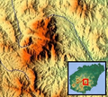 Wuzhi Mountain - Topographical map.png 318 × 285; 199 KB
-
 Wuzhi Shan location 01.jpg 1,500 × 1,295; 81 KB
-
 Wuzhizhou Island - map 01.jpg 1,199 × 758; 543 KB
-
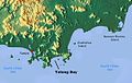 Yalong Bay - map 01.jpg 1,199 × 758; 535 KB
-
 Yangpu Economic Development Zone.jpg 1,500 × 1,295; 207 KB
-
 Карта Янода.jpg 1,055 × 703; 312 KB


.svg)


.jpg)


_-_Fort_Bayard_-_Péninsule_de_Leizhou.png)


