
Category:Maps of Jiangsu
- Provinces of the People's Republic of China
- Anhui
- Fujian
- Gansu
- Guangdong
- Guizhou
- Hainan
- Hebei
- Heilongjiang
- Henan
- Hubei
- Hunan
- Jiangsu
- Jiangxi
- Jilin
- Liaoning
- Qinghai
- Shaanxi
- Shandong
- Shanxi
- Sichuan
- Yunnan
- Zhejiang
- Autonomous regions
- Guangxi
- Inner Mongolia
- Ningxia
- Tibet Autonomous Region
- Xinjiang
- Special administrative regions
- Hong Kong
- Macau
Wikimedia category | |||||
| Upload media | |||||
| Instance of | |||||
|---|---|---|---|---|---|
| Category combines topics | |||||
| Jiangsu | |||||
province of China .jpg) someja da satełite in agosto, in falsi cołori .svg) | |||||
| Instance of | |||||
| Location | PRC | ||||
| Capital | |||||
| Legislative body |
| ||||
| Executive body | |||||
| Head of government |
| ||||
| Party chief representative |
| ||||
| Highest point |
| ||||
| Population |
| ||||
| Area |
| ||||
| Replaces |
| ||||
| Said to be the same as | Jiangsu | ||||
| official website | |||||
 | |||||
Subcategories
This category has the following 5 subcategories, out of 5 total.
Media in category "Maps of Jiangsu"
The following 37 files are in this category, out of 37 total.
-
 1937年淞沪会战时期的宣传品.png 1,080 × 775; 1.43 MB
-
 2015 Jiangsu perCapitaGDP.png 525 × 498; 74 KB
-
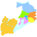
 Administrative Division Jiangsu.svg 1,070 × 1,000; 1.66 MB
-
 Administrative Division Wuxi.png 1,800 × 1,800; 300 KB
-
 Administrative-Division-Changzhou-Icelandic.jpg 886 × 891; 137 KB
-
 China Jiangsu Yizheng Location Map.svg 784 × 756; 214 KB
-
 China Sex Museum map.png 320 × 287; 11 KB
-
 ChinaJiangsuPizhou.png 527 × 500; 55 KB
-
 Expressway in Jiangsu.svg 512 × 469; 655 KB
-
 G1522 map.svg 697 × 717; 190 KB
-
 Gan-Yu County.png 569 × 453; 21 KB
-
 Gan-Yu in East China.png 430 × 455; 36 KB
-
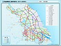 Jiangsu Expressway Network Layout 2017-2035.jpg 1,712 × 1,277; 779 KB
-
 Jiangsu Expressway Network Map 2017-2035.jpg 1,712 × 1,277; 780 KB
-
 Jiangsu expressway network with cities.svg 2,136 × 2,000; 663 KB
-
 Jiangsu expressway network with legend and text.svg 2,136 × 2,000; 1.22 MB
-
 Jiangsu expressway network without cities.svg 2,136 × 2,000; 338 KB
-
 Jiangsu Map.png 250 × 200; 16 KB
-
 Jiangsu outline map.svg 512 × 479; 65 KB
-
.png/120px-Jiangsu_Province(weather).png) Jiangsu Province(weather).png 672 × 624; 44 KB
Jiangsu Province(weather).png 672 × 624; 44 KB
-
 Jiangsu Shadow.png 131 × 112; 823 bytes
-
 Jiangsu-logo.jpg 500 × 618; 76 KB
-
 Jianhu cn.png 2,481 × 2,298; 7.61 MB
-
 Kiangsu province, Republic of China.png 1,280 × 1,001; 40 KB
-
 Map of Shilianghe.JPG 4,611 × 4,166; 8.08 MB
-
 Map of Zhufan Village.JPG 2,170 × 2,315; 885 KB
-
 Map of Zhufan.jpg 983 × 920; 120 KB
-
 Population distribution of Jiangsu in 2010.png 794 × 941; 44 KB
-
 Suyan rock.png 1,063 × 650; 776 KB
-
 UNESCO Coast of Yellow Sea-Bohai Gulf of China Phase I.svg 784 × 756; 140 KB
-
 Yangchenglakemap.png 1,084 × 807; 79 KB
-
 朱范.JPG 2,170 × 2,315; 927 KB
-
 朱范cd.JPG 2,170 × 2,315; 258 KB
-
 朱范村全图.JPG 2,170 × 2,315; 257 KB
-
 濉河干流及其主要支流示意图.png 2,380 × 1,659; 438 KB
-
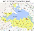
 石梁河镇全图.jpg 4,611 × 3,826; 5.5 MB
-
 石梁河镇全图A.jpg 4,611 × 3,826; 7.1 MB


.png)


