
Category:Maps of Liaoning
- Provinces of the People's Republic of China
- Anhui
- Fujian
- Gansu
- Guangdong
- Guizhou
- Hainan
- Hebei
- Heilongjiang
- Henan
- Hubei
- Hunan
- Jiangsu
- Jiangxi
- Jilin
- Liaoning
- Qinghai
- Shaanxi
- Shandong
- Shanxi
- Sichuan
- Yunnan
- Zhejiang
- Autonomous regions
- Guangxi
- Inner Mongolia
- Ningxia
- Tibet Autonomous Region
- Xinjiang
- Special administrative regions
- Hong Kong
- Macau
Wikimedia category | |||||
| Upload media | |||||
| Instance of | |||||
|---|---|---|---|---|---|
| Category combines topics | |||||
| Liaoning | |||||
province of China  someja satelitar in majo .svg)  | |||||
| Instance of | |||||
| Location | PRC | ||||
| Capital | |||||
| Legislative body |
| ||||
| Head of government |
| ||||
| Party chief representative |
| ||||
| Inception |
| ||||
| Highest point |
| ||||
| Population |
| ||||
| Area |
| ||||
| Replaces |
| ||||
| Different from | |||||
| official website | |||||
 | |||||
Subcategories
This category has the following 9 subcategories, out of 9 total.
Media in category "Maps of Liaoning"
The following 14 files are in this category, out of 14 total.
-
 Administrative Division Liaoning.svg 1,090 × 1,000; 2.27 MB
-
.jpg/120px-Admiralty_Chart_No_2833_Fort_Head_to_Kinchau%2C_Published_1912_(composite).jpg) Admiralty Chart No 2833 Fort Head to Kinchau, Published 1912 (composite).jpg 12,974 × 16,419; 68.34 MB
Admiralty Chart No 2833 Fort Head to Kinchau, Published 1912 (composite).jpg 12,974 × 16,419; 68.34 MB
-
 Admiralty Chart No 2833 Fort Head to Kinchau, Published 1912.jpg 11,298 × 16,521; 62.79 MB
-
 Battle of Nanshan Fullerton 1905.jpg 5,517 × 5,752; 8.15 MB
-
 Battle of Nanshan Map japansfightforfr02wilsuoft 0135.jpg 1,584 × 1,680; 803 KB
-
 Beijing-Harbin Line.png 854 × 724; 27 KB
-
 Cheolli Jangseong.png 670 × 725; 687 KB
-
 China Mantsjoerije.png 250 × 200; 5 KB
-

-
 Liaoning Expressway Network.svg 1,011 × 900; 153 KB
-
 Liaoning Shadow.png 132 × 134; 987 bytes
-
 Manchu autonomous regions in Liaoning.png 503 × 468; 43 KB
-
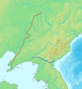
 Map of the Liaodong Wall.jpg 600 × 430; 93 KB
-
 NASA China Northeast.jpg 422 × 415; 146 KB

.jpg)


