
Category:Maps of Qinghai
- Provinces of the People's Republic of China
- Anhui
- Fujian
- Gansu
- Guangdong
- Guizhou
- Hainan
- Hebei
- Heilongjiang
- Henan
- Hubei
- Hunan
- Jiangsu
- Jiangxi
- Jilin
- Liaoning
- Qinghai
- Shaanxi
- Shandong
- Shanxi
- Sichuan
- Yunnan
- Zhejiang
- Autonomous regions
- Guangxi
- Inner Mongolia
- Ningxia
- Tibet Autonomous Region
- Xinjiang
- Special administrative regions
- Hong Kong
- Macau
Wikimedia category | |||||
| Upload media | |||||
| Instance of | |||||
|---|---|---|---|---|---|
| Category combines topics | |||||
| Qinghai | |||||
province of China  someja da satełite in disenbre  .svg) | |||||
| Instance of | |||||
| Location | PRC | ||||
| Capital | |||||
| Legislative body | |||||
| Head of government |
| ||||
| Party chief representative |
| ||||
| Inception |
| ||||
| Highest point |
| ||||
| Population |
| ||||
| Area |
| ||||
| Replaces |
| ||||
| official website | |||||
 | |||||
Subcategories
This category has the following 4 subcategories, out of 4 total.
Media in category "Maps of Qinghai"
The following 31 files are in this category, out of 31 total.
-
 Administrative Division Qinghai.svg 1,450 × 1,000; 1.31 MB
-
 Angqu River Basin map.png 3,520 × 2,032; 504 KB
-
 Ayong River.png 987 × 1,083; 1.65 MB
-
 Banyong River.png 1,478 × 1,134; 2.46 MB
-
 Budangqu River.png 1,137 × 1,208; 2.33 MB
-
 Hoh Xi-Karte.svg 1,351 × 984; 355 KB
-
 Lhasa map.svg 1,520 × 1,059; 201 KB
-
 Location map Qinghai.png 569 × 407; 63 KB
-
 Map of Tibetan Self-Immolations.png 801 × 449; 458 KB
-
 N 30, E 90 - N 40.1. E 106.1 slope map.png 10,757 × 8,250; 60.72 MB
-
 Nagqu map.svg 1,520 × 1,059; 223 KB
-
 Neic vacp cy.png 409 × 371; 228 KB
-
 Ningqu River.png 1,459 × 1,106; 2.54 MB
-
 Oirat-map-ru.png 2,566 × 2,324; 145 KB
-
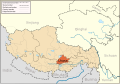
 Physical map of Tibet.png 833 × 490; 446 KB
-
 Qing dynasty and Qinghai.jpg 632 × 480; 45 KB
-
 Qinghai April2010 ShakeMap.jpg 543 × 683; 112 KB
-
 Qinghai Hoh Xil - Map of the inscribed property.png 3,155 × 2,068; 11.08 MB
-
 Qinghai Shadow.png 292 × 215; 2 KB
-
 Sequ River Basin map.png 4,010 × 2,653; 521 KB
-
 Shaqu River.png 1,143 × 1,203; 2.09 MB
-
 SNNR Map only.jpg 2,674 × 1,337; 1.57 MB
-
 SNNR Map.jpg 3,004 × 2,208; 404 KB
-
 Standard Map of Fuyu City Administrative Boundary.jpg 1,320 × 1,726; 297 KB
-
 Standard Map of Haidong City Administrative Boundary.jpg 1,320 × 880; 200 KB
-
 Standard Map of Mile City Administrative Boundary.jpg 1,320 × 887; 182 KB
-
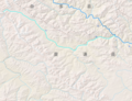
_River.png/120px-The_Source_of_Lancangjiang_(_Mekong)_River.png) The Source of Lancangjiang ( Mekong) River.png 1,702 × 1,177; 3.08 MB
The Source of Lancangjiang ( Mekong) River.png 1,702 × 1,177; 3.08 MB
-
 Tibet&neighbors.svg 1,520 × 1,059; 210 KB
-
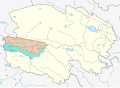
 Tibetan Autonomous Areas Map.png 970 × 608; 59 KB
-
 Topografic map of Tibetan Plateau.png 1,365 × 732; 663 KB
-
 Ziqu River Basin map.png 1,596 × 1,153; 287 KB


_River.png)


