
Category:Maps of Shandong
- Provinces of the People's Republic of China
- Anhui
- Fujian
- Gansu
- Guangdong
- Guizhou
- Hainan
- Hebei
- Heilongjiang
- Henan
- Hubei
- Hunan
- Jiangsu
- Jiangxi
- Jilin
- Liaoning
- Qinghai
- Shaanxi
- Shandong
- Shanxi
- Sichuan
- Yunnan
- Zhejiang
- Autonomous regions
- Guangxi
- Inner Mongolia
- Ningxia
- Tibet Autonomous Region
- Xinjiang
- Special administrative regions
- Hong Kong
- Macau
Wikimedia category | |||||
| Upload media | |||||
| Instance of | |||||
|---|---|---|---|---|---|
| Category combines topics | |||||
| Shandong | |||||
province of China  Mount Tai in Shandong .svg) | |||||
| Pronunciation audio | ⓘ | ||||
| Instance of | |||||
| Location | PRC | ||||
| Capital | |||||
| Legislative body |
| ||||
| Executive body |
| ||||
| Head of government |
| ||||
| Party chief representative | |||||
| Highest point | |||||
| Population |
| ||||
| Area |
| ||||
| Replaces |
| ||||
| Different from | |||||
| official website | |||||
 | |||||
Subcategories
This category has the following 6 subcategories, out of 6 total.
Media in category "Maps of Shandong"
The following 22 files are in this category, out of 22 total.
-
 Administrative Division Shandong.svg 1,580 × 1,000; 3.17 MB
-
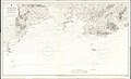
 Admiralty Chart No 3491 Shitau Bay to North East Promontory, Published 1966.jpg 11,276 × 16,490; 47.97 MB
-
 Admiralty Chart No 3554 Tau Tsui Head to Shitau Bay, Published 1973.jpg 18,494 × 11,213; 59.8 MB
-
 G18 map.svg 512 × 422; 157 KB
-
 Koppen-Geiger Map v2 CHN Shandong 1991–2020.svg 1,776 × 850; 1.18 MB
-
 Location of Weishan Lake.jpg 1,515 × 1,155; 142 KB
-
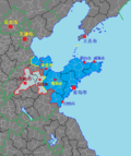
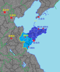
 Map of Shandong Dialects.png 475 × 327; 8 KB
-
 SDP DD.png 444 × 529; 36 KB
-
 SDPCG.png 444 × 529; 37 KB
-
 SDPNSL.png 444 × 529; 30 KB
-
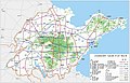 Shandong Expressway Network Map 2016-2030.jpg 1,850 × 1,186; 1.35 MB
-
 Shandong in the Northern Song Dynasty.svg 964 × 666; 75 KB
-
 Shandong in the Qin Dynasty.svg 3,003 × 1,844; 89 KB
-
 Shandong Shadow.png 154 × 105; 883 bytes
-
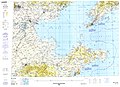 Txu-pclmaps-oclc-22834566 g-10a.jpg 9,421 × 6,846; 16.03 MB
-
 Weihaiwei location map.svg 1,162 × 756; 149 KB
-
 京東東西路.jpg 2,720 × 1,721; 1.63 MB
-
 南燕疆域圖.jpg 3,041 × 2,379; 2.75 MB
-
 山东省秦代区划.svg 480 × 320; 48 KB
-
 山東東路慰宣司.jpg 2,694 × 2,140; 2.27 MB
-
 新建鲁南高速铁路路线图.jpg 2,933 × 1,877; 1.58 MB
-
 辛亥革命山东形势图.png 9,319 × 5,883; 2.76 MB


