
Category:Maps of Shanghai
- Provinces of the People's Republic of China
- Anhui
- Fujian
- Gansu
- Guangdong
- Guizhou
- Hainan
- Hebei
- Heilongjiang
- Henan
- Hubei
- Hunan
- Jiangsu
- Jiangxi
- Jilin
- Liaoning
- Qinghai
- Shaanxi
- Shandong
- Shanxi
- Sichuan
- Yunnan
- Zhejiang
- Autonomous regions
- Guangxi
- Inner Mongolia
- Ningxia
- Tibet Autonomous Region
- Xinjiang
- Special administrative regions
- Hong Kong
- Macau
Wikimedia category | |||||
| Upload media | |||||
| Instance of | |||||
|---|---|---|---|---|---|
| Category combines topics | |||||
| Shanghai | |||||
provincial-level municipality in China .jpg)  .jpg)   .svg) .svg)   | |||||
| Spoken text audio | ⓘ | ||||
| Pronunciation audio | ⓘ | ||||
| Instance of |
| ||||
| Part of | |||||
| Location |
| ||||
| Located in or next to body of water | |||||
| Capital | |||||
| Legislative body |
| ||||
| Executive body | |||||
| Head of government |
| ||||
| Party chief representative | |||||
| Has part(s) | |||||
| Inception |
| ||||
| Significant event |
| ||||
| Highest point |
| ||||
| Population |
| ||||
| Area |
| ||||
| Elevation above sea level |
| ||||
| Replaces |
| ||||
| Said to be the same as | Modu | ||||
| official website | |||||
 | |||||
Subcategories
This category has the following 12 subcategories, out of 12 total.
D
H
I
- Inaccurate maps of Shanghai (54 F)
L
- Locator maps of Shanghai (21 F)
O
P
R
- Road maps of Shanghai (52 F)
T
- Travel maps of Shanghai (5 F)
Media in category "Maps of Shanghai"
The following 44 files are in this category, out of 44 total.
-
 1913年《实测上海城厢租借图》上的兴仁里.jpg 1,581 × 717; 476 KB
-
 Administrative Division Shanghai Municipality.svg 1,000 × 1,200; 166 KB
-
 Administrative Division Shanghai.png 2,600 × 2,980; 1.02 MB
-
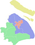
 Administrative Divisions of Hongkou, Shanghai, China.png 2,339 × 3,013; 207 KB
-
 Admiralty Chart No 2946 Ch'ang Chiang Sheet 1, Published 1954.jpg 16,467 × 11,310; 35.11 MB
-
 BlankShanghaiMap.png 1,488 × 1,822; 51 KB
-
 Braille in Shanghai Disney Resort.jpg 3,264 × 2,448; 2.24 MB
-
 ColorShanghaiMap.png 483 × 623; 11 KB
-
 ColorShanghaiMapNew.png 707 × 623; 13 KB
-
 Downtown Shanghai districts map.png 406 × 476; 251 KB
-
 Forest Park Plan.jpg 2,048 × 1,536; 1.46 MB
-
 Hangzhou Shanghai Road and Railroad.svg 1,417 × 531; 78 KB
-
 Location of Zhujing town.svg 965 × 1,111; 64 KB
-
 Mono-color Shanghai Map.svg 512 × 512; 18 KB
-
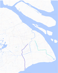
 Rivers of Hongkou, Shanghai, China.tif 2,316 × 2,978; 637 KB
-
 Shanghai China printable map level 12.svg 4,070 × 4,754; 6.93 MB
-
 Shanghai China street map.svg 9,233 × 10,201; 26.7 MB
-
 Shanghai City Limits.svg 654 × 678; 122 KB
-
 Shanghai city plan map China Level 12.svg 4,160 × 4,832; 7.09 MB
-
 Shanghai commuter rail 2025.png 6,223 × 7,064; 5.45 MB
-
 Shanghai commuter rail 2025.svg 512 × 530; 3.3 MB
-
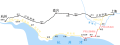
 Shanghai Commuter Rail Airport Link Line.png 3,221 × 763; 721 KB
-
 Shanghai Commuter Rail Airport Link Line.svg 512 × 121; 619 KB
-
 Shanghai Commuter Rail Jiamin Line 2025.svg 512 × 997; 895 KB
-
 Shanghai districts map inner.svg 835 × 730; 2.8 MB
-
 Shanghai Jewish Refugees Museum guide engaging with Ambassador Burns in front of a map.jpg 2,800 × 1,866; 1.09 MB
-
 Shanghai LifeHacks Burger Map.jpg 800 × 638; 359 KB
-
_ILS_Approach.svg/120px-Shanghai_Pudong_(PVG_ZSPD)_ILS_Approach.svg.png) Shanghai Pudong (PVG ZSPD) ILS Approach.svg 823 × 894; 2.02 MB
Shanghai Pudong (PVG ZSPD) ILS Approach.svg 823 × 894; 2.02 MB
-
 Shanghai Shadow.svg 520 × 517; 4 KB
-
 Shanghai Shape.svg 500 × 500; 6 KB
-
 Shanghai-map.jpg 2,500 × 2,966; 769 KB
-
 Shanghaicommuniterrail20141228.png 7,415 × 9,307; 5.73 MB
-
 ShanghaiInner.jpg 1,164 × 1,127; 120 KB
-
 The 11 sections of Lin-gang Special Area.jpg 458 × 461; 38 KB
-
 The border of Minhang Development Zone.svg 512 × 571; 121 KB
-
_land_use.jpg/120px-The_first_draft_of_the_Greater_Shanghai_Plan(1946)_land_use.jpg) The first draft of the Greater Shanghai Plan(1946) land use.jpg 587 × 800; 204 KB
The first draft of the Greater Shanghai Plan(1946) land use.jpg 587 × 800; 204 KB
-
 《上海市第一次地理国情普查公报》图五《上海市铁路与道路》.png 7,371 × 9,926; 7.53 MB
-
_图集.pdf/page1-120px-上海市城市总体规划_(2017-2035年)_图集.pdf.jpg) 上海市城市总体规划 (2017-2035年) 图集.pdf 1,268 × 1,752, 50 pages; 15.26 MB
上海市城市总体规划 (2017-2035年) 图集.pdf 1,268 × 1,752, 50 pages; 15.26 MB
-
 东方大港计划-上海.png 928 × 1,338; 407 KB
-
 乔家路地块旧城区改建范围及分块实施示意图.png 740 × 622; 701 KB
-
 华阳社区C040101编制单元控制性详细规划 1.jpg 4,681 × 3,311; 5.09 MB
-
 华阳社区C040101编制单元控制性详细规划 2.jpg 4,681 × 3,311; 5.01 MB
-
 吴淞炮台形势图.jpg 4,032 × 3,024; 2.1 MB
-
 崇明县.png 553 × 969; 73 KB


_ILS_Approach.svg)


_land_use.jpg)


