
Category:Maps of Zhejiang
- Provinces of the People's Republic of China
- Anhui
- Fujian
- Gansu
- Guangdong
- Guizhou
- Hainan
- Hebei
- Heilongjiang
- Henan
- Hubei
- Hunan
- Jiangsu
- Jiangxi
- Jilin
- Liaoning
- Qinghai
- Shaanxi
- Shandong
- Shanxi
- Sichuan
- Yunnan
- Zhejiang
- Autonomous regions
- Guangxi
- Inner Mongolia
- Ningxia
- Tibet Autonomous Region
- Xinjiang
- Special administrative regions
- Hong Kong
- Macau
Wikimedia category | |||||
| Upload media | |||||
| Instance of | |||||
|---|---|---|---|---|---|
| Category combines topics | |||||
| Zhejiang | |||||
province of China  someja satełitar in novenbre, in toni de grizo .svg) | |||||
| Instance of | |||||
| Location |
| ||||
| Capital | |||||
| Legislative body |
| ||||
| Head of government |
| ||||
| Party chief representative |
| ||||
| Highest point |
| ||||
| Population |
| ||||
| Area |
| ||||
| Replaces |
| ||||
| official website | |||||
 | |||||
Subcategories
This category has the following 6 subcategories, out of 6 total.
Media in category "Maps of Zhejiang"
The following 37 files are in this category, out of 37 total.
-
 1937年淞沪会战时期的宣传品.png 1,080 × 775; 1.43 MB
-
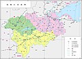
 Administrative Division Zhejiang.svg 1,080 × 1,000; 3.75 MB
-
 Admiralty Chart No 1453 Pa-Ko Lieh-Tao, Published 1961.jpg 11,282 × 8,199; 18.67 MB
-
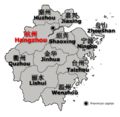
 China Zhejiang Jinhuacity.png 564 × 471; 52 KB
-
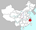
 China Zhejiang location map.png 1,018 × 972; 46 KB
-
 ChinaZhejiang.png 520 × 505; 308 KB
-
 Disputed Area between Zhejiang & Fujian Provinces of China.png 1,710 × 1,160; 321 KB
-
 Eastern Zhejiang Canal en.svg 1,033 × 364; 29 KB
-
 Eastern Zhejiang Canal.svg 1,033 × 365; 21 KB
-
 G1512 map.svg 630 × 683; 181 KB
-
 G1522 map.svg 697 × 717; 190 KB
-
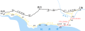 Hangzhou Shanghai Road and Railroad.svg 1,417 × 531; 78 KB
-
 Jiangnan Canal and Hangzhou Second Channel.svg 1,417 × 815; 161 KB
-
 Jiaxing mcp.jpg 500 × 473; 13 KB
-
 Location Hangzhou Bay Bridge.PNG 612 × 438; 78 KB
-
 Map of Urban Jinhua.png 759 × 818; 346 KB
-
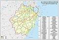
 Map of Zhejiang 2017 County-level.svg 939 × 905; 2.38 MB
-
 Map Zhejiang adm.png 1,730 × 1,653; 536 KB
-
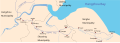
 Map-of-the-Qiantang-River.jpg 3,593 × 2,608; 559 KB
-
 Ningbo mcp.jpg 500 × 570; 19 KB
-
 Qiandaohu.svg 893 × 589; 592 KB
-
 Qiantang River Bridge Plan - Map of Zhejiang.pdf 2,195 × 1,575; 118 KB
-
 Qixing Islets.png 600 × 572; 20 KB
-
 She ethnic county, townships and towns in Zhejiang.png 497 × 500; 44 KB
-
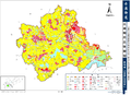 The Comprehensive Lan Use Planning For CHIXI.png 2,758 × 1,990; 2.76 MB
-
 Wuyue Kingdom, 978.svg 737 × 1,063; 91 KB
-
 Wuyueh region map2.gif 724 × 707; 105 KB
-
 Wuyuehmap.PNG 658 × 543; 13 KB
-
 Yuhuan map draft.jpg 2,560 × 1,376; 277 KB
-
 Zhejiang Expressway Network Map 2021-2035.jpg 1,523 × 1,041; 688 KB
-
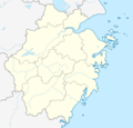
 Zhejiang map.png 442 × 416; 46 KB
-
 Zhejiang ROC.jpg 391 × 346; 15 KB
-
 Zhejiang Shadow.png 95 × 103; 677 bytes
-
 Zhejiang.png 612 × 508; 180 KB
-
 东方大港计划-乍浦.png 1,032 × 1,472; 649 KB
-
.jpg/120px-浙江高速鐵路網(繁體中文).jpg) 浙江高速鐵路網(繁體中文).jpg 520 × 505; 64 KB
浙江高速鐵路網(繁體中文).jpg 520 × 505; 64 KB
-
.jpg/120px-浙江高速铁路网(简体中文).jpg) 浙江高速铁路网(简体中文).jpg 520 × 505; 64 KB
浙江高速铁路网(简体中文).jpg 520 × 505; 64 KB


.jpg)
.jpg)